

Umm Yifenah Island Abu Dhabi: Location, Bridge and Development
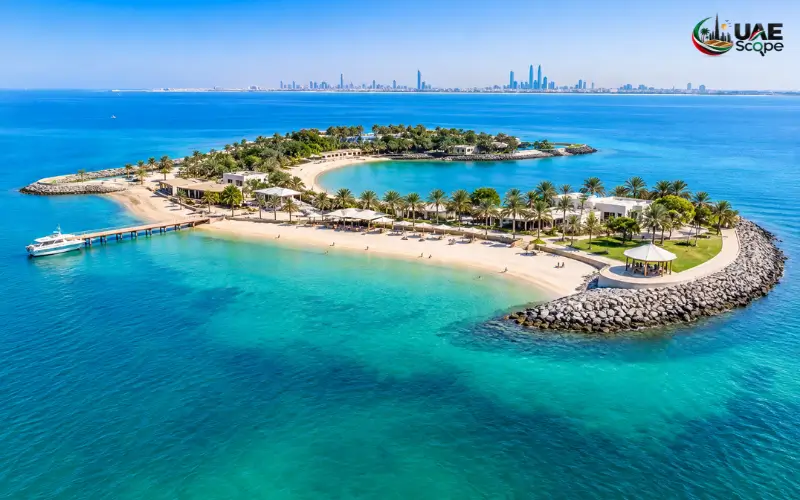
Umm Yifenah Island is one of the islands included in Abu Dhabi’s expanding road network. It has gained attention because of the Umm Yifenah Bridge and the Mid-Island Parkway project, which will improve connections between several islands and mainland areas. These developments are part of the emirate’s plans to make travel easier and provide better access to growing residential communities.
Many people search for Umm Yifenah Island to learn about its location, nearby areas, road connections and future development. However, the island is mainly known for its transport infrastructure rather than tourist attractions. Its bridge, planned roads and walking and cycling routes are the main features associated with the area.
This guide covers the island’s location, Umm Yifenah Bridge, the Mid-Island Parkway project and the expected changes to Abu Dhabi’s road network.
Quick Facts About Umm Yifenah Island Abu Dhabi
| Detail | Information |
| Island name | Umm Yifenah Island |
| Official spelling | Umm Yifenah Island |
| Emirate | Abu Dhabi, UAE |
| Main road connection | Umm Yifenah Bridge |
| Nearby areas | Al Reem Island and Saadiyat Island |
| Major road project | Mid-Island Parkway |
| Bridge inauguration | 9 February 2023 |
| Main importance | Road connectivity and transport |
| Walking and cycling routes | Included in infrastructure plans |
| Tourist facilities | No confirmed information about major visitor facilities |
Where Is Umm Yifenah Island Located in Abu Dhabi?
Umm Yifenah Island is located in Abu Dhabi, the capital of the United Arab Emirates. It forms part of the emirate’s coastal island network and is connected to major road development projects. Its position is important because it lies along a transport corridor planned to link several islands and mainland communities.
Umm Yifenah Bridge connects the island with Al Reem Island and Sheikh Zayed bin Sultan Street. The Mid-Island Parkway is another major project associated with this location. Once its planned sections are completed and opened, the road will provide further connections towards Saadiyat Island and other parts of Abu Dhabi.
Umm Yifenah Island is not the same as Umm Al Quwain. This is a separate emirate in the northern UAE, while Umm Yifenah Island is in Abu Dhabi. This distinction is useful when searching for the island or checking directions.
Nearby Islands and Areas
Several islands and mainland areas are connected to, or included in, the wider road plans around Umm Yifenah Island.
- Al Reem Island: A developed area with residential towers, offices, shops and waterfront communities.
- Saadiyat Island: Known for its beaches, cultural attractions, hotels and residential developments.
- Bilrimaid Island: Included in the planned Phase Two route of the Mid-Island Parkway.
- Samaliyah Island: Another island covered by the future road connection plans.
- Sas Al Nakhl: An area included in the wider Phase Two route.
- Al Raha Beach: A coastal area with residential communities and commercial properties.
- Khalifa City: A large residential area included in the planned road corridor.
These places are spread across different parts of Abu Dhabi. The purpose of the road project is to provide better connections between them and reduce the need for longer journeys through existing routes.
Umm Yifenah Island on the Map
You may find two spellings when searching for the island: Umm Yifenah Island and Umm Yifenah Island. Both names refer to the same Abu Dhabi location, although Umm Yifenah is the spelling used in official project information.
Umm Yifenah Bridge and the Mid-Island Parkway are useful names to check when looking for the area on a map. Road layouts may change as construction progresses, so check current directions before travelling. A road shown in a development plan may not yet be open to the public.
What Is Umm Yifenah Island Known For?
Umm Yifenah Island is mainly known for its role in Abu Dhabi’s transport development. The island forms part of a wider plan to improve road connections between coastal areas, islands and mainland communities.
Umm Yifenah Bridge is one of its main road connections. It links the island with Al Reem Island and Sheikh Zayed bin Sultan Street. The Mid-Island Parkway is also associated with the area and is planned to add more roads, bridges and facilities for pedestrians and cyclists.
Unlike some other Abu Dhabi islands, Umm Yifenah is not widely known for hotels, public beaches or entertainment attractions. There is no confirmed information about a major collection of visitor facilities on the island. Its main importance is its location and the transport projects planned around it.
Umm Yifenah Bridge: Opening Date Length and Main Features
Umm Yifenah Bridge is one of the vital roads in Abu Dhabi. It links Al Reem Island, Umm Yifenah Island and Sheikh Zayed bin Sultan Street. The bridge was designed to facilitate the movement of traffic and to enhance the link between these areas.
On 9 February 2023, the bridge was opened to the public. It is about 11 kilometres in length with six traffic lanes. It can reportedly handle approximately 6,000 trains an hour in both directions, making it possible to use the connection by many vehicles.
There are 2 overwater bridges with a total length of about 3.8 kilometres. In addition, walking and cycling paths are included within the bridge infrastructure, allowing people to travel without a car.
Main Features of Umm Yifenah Bridge
| Feature | Details |
| Inauguration date | 9 February 2023 |
| Length | Approximately 11 km |
| Traffic lanes | Six lanes |
| Traffic capacity | Around 6,000 journeys per hour in each direction |
| Overwater bridges | Two |
| Combined overwater bridge length | Approximately 3.8 km |
| Road connections | Al Reem Island, Umm Yifenah Island and Sheikh Zayed bin Sultan Street |
| Other facilities | Walking and cycling paths |
How Does the Bridge Help Drivers?
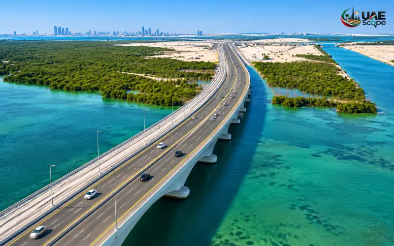
Bridges play a significant role in an island city, as road travel may be longer due to water and coastal areas. Drivers may have to use other roads to get to other communities if they do not have any direct connections. A bridge can shorten the path and connect areas of access.
Umm Yifenah Bridge connects Al Reem Island, Umm Yifenah Island and Sheikh Zayed bin Sultan Street. It has six lanes to accommodate traffic flow in both directions and links the area to the overall road network in Abu Dhabi.
The bridge is also part of a larger transport plan. As more sections of the Mid-Island Parkway are opened, its significance will increase.
Mid-Island Parkway Project: Latest Development in 2026
The Mid-Island Parkway is a key road project that will link together various islands and mainland regions in Abu Dhabi. It will feature new roads and bridges, as well as an underground channel and walking/biking trails. The project is in phases, each feeding into the road network.
The Department of Municipalities and Transport, Abu Dhabi, revealed that Phase One had an allocation of AED 2.85 billion and would be completed in 2027 on 1 October 2026. This stage will play an important role in connecting Saadiyat Island with Umm Yifenah Island through this road.
The project will make travel between various localities in Abu Dhabi more direct. It also includes pedestrian and bicycle paths and construction techniques suitable for the coastal environment.
Phase One: Road Connection to Umm Yifenah Island
Phase One starts at the existing northern Saadiyat interchange on E12. The road cuts through southern Saadiyat Island and heads towards the Umm Yifenah Island Central Interchange.
The designed road would be an eight-lane-wide dual carriageway road comprising four lanes on each side. This will create extra roadway for transportation between Saadiyat Island and the connected areas.
The advantage expected for one is the shorter distance between Saadiyat Island and Al Reem Island or the main island of Abu Dhabi. Once these sections of road are built and open, the journey time to these destinations could be reduced from about 25 minutes to about 10 minutes, according to project estimates. These are estimates and not guaranteed travel times for existing journeys.
Underground Channel and Underwater Section
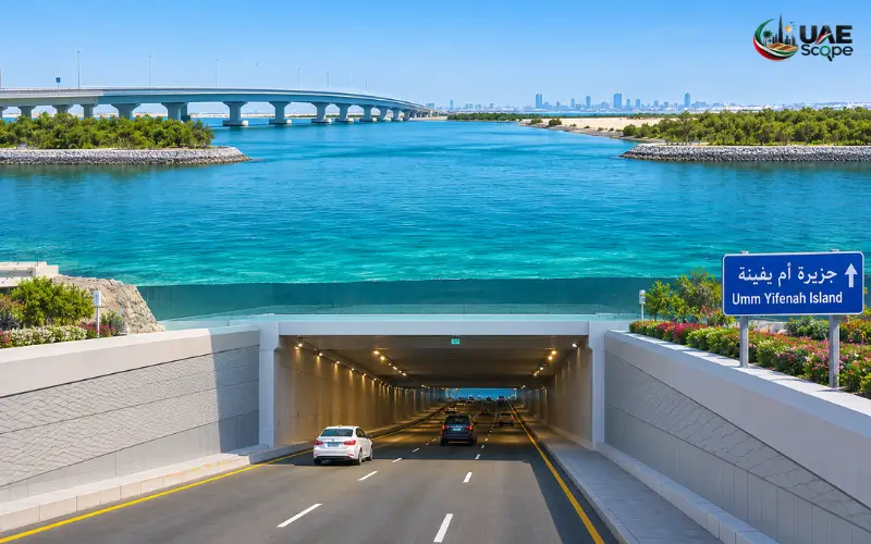
One of the key components of Phase One is an underground channel, approximately 1.5 kilometres in length. It also features a 600-metre underwater stretch below Khor Laffan, which will be built at a depth of some 11 metres.
Roof panels are precast concrete panels that are part of the construction design. This section is for the road route to go through the coastal stretch in the context of the broader transport route.
About two kilometres of reclaimed land are also part of the project. The rock covering for this area is around 150,000 square metres of protective rock covering. These works are used to maintain the structure of the roads and to ensure the safety of the developed sections.
Walking and Cycling Paths
The Mid-Island Parkway is not just for cars. Phase One is approximately 4km of walking and cycling paths. The tracks will be part of a 12-kilometre-long continuous path that will run across Saadiyat Island to Umm Yifenah Island.
Once open to the public, the paths will serve as another means of connectivity between the areas. They can also provide shorter trips for residents and visitors for walking and biking.
Access will be via each section as they are completed and opened. Local signage should be followed, and construction sites and incomplete paths avoided.
Environmental and Energy-Saving Features
The project contains provisions that will take into account the environment of the surrounding coastal areas and local climate. Locally sourced and recycled construction materials and smart lighting and landscaping with native plants are examples of these.
Around 23,000 linear metres of smart, energy-saving lighting systems are planned to be installed. They also feature an irrigation system of approximately 14,000 linear metres and native plants that are drought-tolerant.
These features are part of the site-planning and landscaping for the project. They exist to assist the new road, with consideration of local environmental factors.
Phase Two: Extending the Road Network
Phase Two will be the extension of the Mid-Island Parkway to Umm Yifenah Island. The proposed route is about 14.5 kilometres and will link Umm Yifenah to Bilrimaid Island, Samaliyah Island, Sas Al Nakhl, Al Raha Beach and Khalifa City.
The new street will be an east-west highway with four lanes on each side. It features marine bridges, flyovers and a subterranean road tunnel. The plans also include walking and cycling tracks.
The estimated time on the mid-island route is approximately seven minutes when the appropriate connection is available. This is an estimate for a project and should not be used as a driver journey time at present.
Protection of the environment is also included in the Phase Two plans. It seeks to conserve mangroves, salt marshes, coastal sabkha areas, and maintain the natural water channels.
How Does Umm Yifenah Island Connect Abu Dhabi’s Other Islands?
Umm Yifenah Island is one of the extended Islands and coastal areas in Abu Dhabi. It is integrated with roads to connect locations that may have longer journeys via known roads.
One of the main areas linked through Umm Yifenah Bridge is Al Reem Island. The bridge also connects to Sheikh Zayed bin Sultan Street, providing a connection to the broader road network.
Another vital component of the planned connection is Thadiyat Island. Phase One of the Mid-Island Parkway will connect the existing northern Saadiyat interchange with the Umm Yifenah Island Central Interchange. This will give a more direct road once opened once completed.
The intended second phase will continue the corridor towards the Bilrimaid and Samaliyah islands, then move on to Sas Al Nakhl, Al Raha Beach, and Khalifa City. The connections are supposed to ease the journey between several areas of Abu Dhabi.
Environmental Protection Around Umm Yifenah Island
The Coastal Areas in Abu Dhabi include Mangroves, salt marshes, shallow waters, and coastal sabkha. These natural spaces are home to wildlife and are significant to the local coastal environment.
Plans for the Mid-Island Parkway incorporate strategies to minimize the impacts of construction on these surroundings. Phase Two is intended to safeguard areas of mangroves, salt marshes,, and coastal sabkhas from the removal of natural water channels.
The broader project will also feature native plants and an irrigation system. The features are designed to cater for the local climate and to landscape the new road infrastructure.
Not all stretches of coastline are public. There may be limitations due to construction, environmental protection, or other access limitations. Local signage and directions must be followed when travelling near the island.
How to Reach Umm Yifenah Island
The roads surrounding Umm Yifena Island are connected to the wider transport system in Abu Dhabi. The safest path will depend on where you are starting and which parts of the roads are open.
By Car
A car is a convenient method to get to areas that are linked via Umm Yifena Bridge. The roads available for motorists to use connect Al Reem Island to Abu Dhabi’s Sheikh Zayed bin Sultan Street and other areas.
Individuals who are traveling from Saadiyat Island should check road directions before they head out. The entire connection planned for Phase One relies on the new roads being opened. Routes that are part of a project announcement can’t be included in the everyday driving experience.
By Public Transport
Before travelling by public transport in Abu Dhabi, find out what buses are running. The presence of a bridge or road does not imply a bus service or stop on the island.
If no direct bus route is given for your destination, then a taxi or private car ride might be better. Before you leave, check the information about the routes as they may change.
By Walking or Cycling
The bridge infrastructure and Mid-Island Parkway plans include walking and cycling paths. A number of tracks are planned for Phase One, to link Saadiyat Island to Umm Yifenah Island.
These paths will only be available if the appropriate sections are finished and open. Never enter construction areas or incomplete tracks. Look at local signs before embarking on a walk or ride.
Is Umm Yifenah Island a Tourist Destination?
Umm Yifenah Island isn’t a well-known tourist attraction. It is primarily linked to the development of the road and bridges, and to the future transport network in Abu Dhabi. The most common queries regarding the island are about its location, road connections, and construction projects.
No information is available about the existence of a large scale of public sites for visitors on the island. Please be aware that it does not have public beaches, hotels, restaurants, camping areas or organised water activities.
Established places like Saadiyat Island and other developed areas of Abu Dhabi offer people a place to find beaches, culture and leisure activities. Facilities for visitors are better known in these areas but opening hours and conditions of access may be checked before visiting.
Before visiting the area around the Umm Yifenah Island, it is necessary to make sure the area is available to the public. The areas may be used for roads and other infrastructure projects. Obey traffic signs and restrictions.
Nearby Islands and Places to Know
The main road network around Umm Yifenah Island is linked to several of the islands in Abu Dhabi. Some are sites of settlement or tourist attraction and others are to be incorporated into future road schemes.
| Nearby island or area | What it is known for |
| Al Reem Island | Residential towers, offices, shops and waterfront communities |
| Saadiyat Island | Cultural attractions, beaches, resorts and residential areas |
| Bilrimaid Island | Included in the planned Phase Two road corridor |
| Samaliyah Island | Part of the future Mid-Island Parkway route |
| Sas Al Nakhl | Included in the planned Phase Two connection |
| Al Raha Beach | Waterfront communities, homes and commercial areas |
| Khalifa City | Large residential area in Abu Dhabi |
In particular, Al Reem Island and Saadiyat Island are relevant as they are part of the existing and planned road connections around Umm Yifenah Island. The other sites are part of the greater Phase Two route.
Future Development and Importance of Umm Yifenah Island
Umm Yifenah Island is closely connected to the road development plans in Abu Dhabi. The Mid-Island Parkway is designed to serve as a more direct route to increase connections between island and mainland communities. New sections will be opened and travel between these areas will be easier.
The Department of Municipalities and Transport (DMT) announced in October 2026 that Phase One would be completed in 2027. The extension of the road corridor towards Bilrimaid, Samaliyah, Sas Al Nakhl, Al Raha Beach and Khalifa City will be implemented in Phase Two.
Once the entire Parkway is completed, the proposed road network will help to shorten the time between Saadiyat Island and Zayed City to less than 15 minutes. This is an indicative journey time, and not a guarantee.
The new routes could also facilitate residential and commercial development in the areas that they serve. Improved connectivity will facilitate travel between various areas of the emirate by making it easier for residents, workers and businesses to get from the one area to another.
Umm Yifenah Island Compared with Other Abu Dhabi Islands
There are several islands in Abu Dhabi, each serving a specific function and having its own characteristics. Every one of them is famous for its residential areas, or for its beaches, cultural attractions, and entertainment facilities. Umm Yifenah Island is unique as its primary significance is related to the road network and transport development.
| Island | Main features |
| Umm Yifenah Island | Umm Yifenah Bridge and Mid-Island Parkway development |
| Al Reem Island | Residential and commercial communities |
| Saadiyat Island | Cultural attractions, beaches, hotels and leisure destinations |
| Jubail Island | Residential communities and natural surroundings |
| Yas Island | Theme parks, entertainment, hotels and leisure activities |
This comparison shows that Umm Yifenah Island has a different role from visitor destinations such as Saadiyat Island and Yas Island. Its importance is mainly connected to the road network and future infrastructure rather than tourist attractions.
Conclusion
Umm Yifenah Island is a vital component in Abu Dhabi’s growing road network. It is primarily a bridge to Umm Yifenah and the Mid-Island Parkway to enhance links between Al Reem Island, Saadiyat Island and other areas of the emirate.
Phase One of the Mid-Island Parkway is due to be completed in 2027, and Phase Two will continue the Parkway road corridor towards additional islands and mainland communities. The project also involves walking and cycling tracks, bridges, and coastal environment construction works.
The primary interest of Umm Yifenah Island is its position and role in the transport development in Abu Dhabi for those who are researching the island. It is not intended to be a major tourist attraction with known public beaches, hotels,l,s or leisure facilities.
Must Visit: Al Wathba Salt Lake Abu Dhabi: Location, How to Reach, Things to Do & Visitor Guide
FAQ’s
What is the name of Umm Yifenah Island?
Umm Yifenah Island is in Abu Dhabi, UAE. It is part of the coastal island network in the emirate and is related to the Umm Yifenah Bridge and Mid-Island Parkway project.
2. Please note that Umm Yifenah Island is NOT in Abu Dhabi?
Yes. Umm Yifenah Island is in Abu Dhabi. It does not form part of the Emirate of Umm Al Quwain, which is located in the north ofthe UAE.
Yes, Umm Yifenah Island is located close to Al Reem Island.
One of the key areas linked via the surrounding road infrastructure is Al Reem Island. This is Umm Yifenah Bridge, which connects Al Reem Island and Umm Yifenah Island, and Sheikh Zayed bin Sultan Street.
4. What does Umm Yifenah Island live up to its reputation as?
Umm Yifenah Bridge and the Mid-Island Parkway project are the main projects the island is known for. The developments are part of the plan to enhance road connectivity between the islands of Abu Dhabi and mainland areas.
5. When did Umm Yifenah Bridge open?
The Umm Yifenah Bridge was opened on 9th February 2023. It connects Al Reem Island, Umm Yifenah Island and Sheikh Zayed bin Sultan Street.
6. How long is Umm Yifenah Bridge?
Umm Yifenah Bridge is approximately 11 kilometres long. It has six traffic lanes and a reported capacity of around 6,000 journeys per hour in each direction.
7. Does Umm Yifenah Bridge have walking and cycling paths?
Yes. Walking and cycling paths are included in the bridge infrastructure. The wider Mid-Island Parkway project also includes dedicated tracks for pedestrians and cyclists.
8. What is the Mid-Island Parkway project?
The Mid-Island Parkway is a major road project in Abu Dhabi. It is planned to connect several islands and mainland areas through new roads, bridges, an underground channel, and walking and cycling tracks.
9. How much does Phase One of the Mid-Island Parkway cost?
Phase One has an announced budget of AED 2.85 billion. The Department of Municipalities and Transport announced on 1 October 2026 that this phase was scheduled for completion in 2027.
10. When will Phase One of the Mid-Island Parkway be completed?
Phase One is scheduled for completion in 2027. It includes an eight-lane road connection between the existing northern Saadiyat interchange and Umm Yifenah Island Central Interchange.